A Historical Journey of Everest

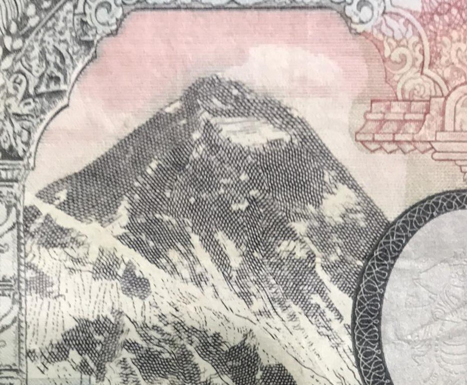
Mount Everest, known as the National Emblem of Nepal, and the peak that adorns every banknote of the Nepali rupee.
A symbol that also holds a profound political significance for the people of this Himalayan country. Nepal’s tourism-reliant economy, significantly relies on Mt. Everest- an emblem of adventure and a mountainous lifestyle inherently surrounded by challenges.
While the peak consistently makes headlines due to daring feats, little gets discussed about the natural creation process of the structure, the origin of its name, and the political dynamics of the geological formation. Therefore, several questions arise- How did such peaks come into existence? What is the religious significance of this peak? How did experts calculate the height of Mt. Everest and conclude it to be the highest peak, or is it indeed the highest peak on Earth?
Mt. Everest is not the tallest peak while being measured from the Earth’s core. This distinction uniquely belongs to Chimborazo, a mountain located in Ecuador. The rationale behind this distinction is grounded in the Earth’s bulge at the equator- a phenomenon that elevates sea levels along this imaginary line. Consequently, when we calculate the mountain’s height relative to sea level, Mt. Everest indisputably emerges as the supreme pinnacle.
The Himalayas consist of sedimentary and metamorphic rocks. The enormous pressure within the ocean creates such types of rock. Emerging a question- How did the geological structures ascend to form the highest peaks on the earth above sea level?
The awe-inspiring answer lies in the distant past. Approximately 40 to 50 million years ago, the Indian landmass collided with the Eurasian plate. This titanic event catalyzed the formation of the Himalayan mountain range, a spectacle of magnificent grandeur that undoubtedly contributed to shaping its religious significance.
Tibetans and indigenous Nepali communities call the majestic peak ‘Chomolungma,’ a name signifying the Mother Goddess of the Earth. Locals believe that the top of the peak is the abode of Miyolangsangma, a Buddhist goddess embodying the concept of ‘Inexhaustible Giving.’ Therefore, climbers who venture to summit the magnificent peak must perform sacred rituals and make offerings at a lhap-so, a shrine constructed near the Everest Base Camp.
The legend of the Tibetan guru Milrepa, the goddess Miyo Losangma, and her four sisters traces its roots back to the 11th century. Nevertheless, the quest for more precise historical dates remains essential to foster a concrete understanding of the historical journey that has shaped Nepal’s national identity and played a pivotal role in diplomatic ties between Nepal and China.
Between 1715 and 1717, Chinese surveyors Shengzhu, Churbizanbo, and Lanbenchanba conducted the monumental task of surveying the vast Tibetan plateau. This significant undertaking would later serve as the basis for China’s future claims over the peak and provide data for future cartographic endeavors aimed at comprehending the region.
The works of the surveyors found their way into Kangxi Atlas in 1721, marking the moment when the name "Qomolangma" would be heard by the public as they learned about the Himalayas.
In 1733, the map was enhanced by Jean-Baptiste Regis, a French missionary, and the refinement process continued with the contributions of Jean Baptiste Bourguignon d’Anville, who based their work on the Kangxi Atlas, and they called the peak- M. Tchoumour Lancma.
Fast forward to 1836, the German geographer Juliys Klaprotto published his map of Central Asia, marking the peak as Disomo Langma, adding another name to the mountain's ever-expanding list of nomenclature.
The British Surveyor of India embarked on a quest to identify the tallest peak in the world, studying various peaks in the subcontinent. During their investigation, they realized an unknown peak that held the potential to be the world’s tallest peak, and they provisionally called it "Peak XV.”
In 1847, British Surveyors in India took a bold step by declaring the height of Peak XV to be 8,778 meters, marking a significant milestone in their exploratory journey.
However, in 1856, the meticulous efforts of the Great Trigonometrical Survey of India led to a more refined estimate. Astonishingly close to the mountain’s true height, they calculated “Peak XV” to be a staggering 29,002 feet above sea level.
As the true stature of the mountain became increasingly evident, the significance of the name grew greater. The peak no longer remained a geographic endeavor but became important for political dimensions.
On May 11, 1857, the “Peak XV” whose real name remained a mystery to surveyors, themselves would give the peak their name. Andrew Waugh with his effort to acknowledge the contribution of his predecessor, the British Surveyor General of India, Sir George Everest. Andrew Waugh became the person to name the highest peak Mount Everest honoring Sir George Everest.
In 1921, George Mallory led a pioneering expedition, marking the first expedition to conquer Mt. Everest from the Chinese side. In 1924, ‘The Epic of Everest’ was produced by George Mallory and Andrew Irvine, it is one of the earliest documentaries on the heroic expedition that also showcases local life on the Tibetan side of the peak.
Nepal’s closed-door policy prohibited mountaineers from entering Nepal, so mountainers conducted their expeditions from a rougher terrain via the northern side of Mt. Everest. This circumstance made Everest a formidable challenge for several decades until Nepal eventually opened its borders to mountaineers.
The mountain universally famed as Mt. Everest, has more names as national actors give new names to create a national bond with the peak. In 1939, Baburam Acharya published his book “Sagarmatha or Jhyamolongma.” At that time, the Ranas, the ruling oligarchs of Nepal had a sweet relationship with the British and did not endorse a local name. However, Baburam Acharya's work paid off, and gets credit for coining the name “Sagarmatha,” a term that gained widespread popularity in Nepal that reflects Nepal’s national identity.
Some Nepalese perceive “Everest” as a later colonial imposition, and “Sagarmatha” represents the authentic, indigenous name. However, it’s crucial to recognize that “Everest” and other names over the peak had political motivations, connected directly with its global popularity.
The historic ascent of Mt. Everest in 1953 by Edmund Hillary and Tenzing Norgay garnered international attention and played a pivotal role in solidifying Nepal’s claim and ownership over the highly celebrated structure. A documentary was produced even discussing the British coronation that added value to the ascension of the peak. At the same time, the Chinese Communist Party was facing its struggles for formal recognition as a state and faced challenges to display ownership over a celebrated structure.
In 1959, Chairman Mao Zedong had a conversation with the Prime Minister of Nepal, BP Koirala, where the Chairman questioned the Prime Minister: ”Why does Nepal not even have a name for the peak in your language?”
BP had recalled, at that moment or with someone’s reminder, that it was known as ‘Sagarmatha.’ Unfortunately, he was new to this term and responded, “You do not have a name for the peak either. ‘Chomolongma’ is a is a Tibetan name.” Mao countered by asserting that Tibet is China.
Finally, a pivotal juncture occurred during the singing of the Sino-Nepalese Border Treaty on October 5, 1961. Within this Boundary Treaty, Article I, Clause 11, officially designated the peak as “Mount Jolmo Lungma (Sagar Matha),” thus sealing the legal name as “Jolmo Lungma” alongside “Sagar Matha”. This agreement formalized the dual name and established the peak as an international boundary marker.
The journey of the peak, from its natural formation to its socio-religious significance, its mathematical measurements, and finally to political evolution, make it an incredible story.
Climbing the peak has been a trophy sought by numerous adventurers, and it has maintained its relevance due to the periodic introduction of adventure sports in the vicinity of the world’s highest peak above sea level.
Stay updated by following us on Instagram and Facebook.
Author
Kripendra Amatya, Researcher, Nepa~laya Productions
Editor
Dana Moyal Kolevzon, Director of International Relations, Nepa~laya Productions
Published Date
September 7, 2023


